Escalas
Categorías
Mostrando 10 de 358 mapas disponibles:

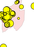
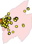
Corrientes - Superficie de Suelo Ofertada (2004)
Se componen con la superficie total ofrecida del l...
Corrientes - Superficie de Suelo Ofertada (2001)
Se componen con la superficie total ofrecida del l...

Índice maximo de magnitud de inundaciones 2000
Indica la magnitud máxima de daño que han alcanzad...
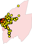
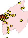
Corrientes - Precio de Suelo (2013)
Precio ofrecido del lote o terreno en pesos a trav...
Índice maximo de magnitud de inundaciones 1990
Indica la magnitud máxima de daño que han alcanzad...
Areas protegidas con manejo que permite el uso sustentable de recursos (UICN de categoria IV-VI)
Muestra el porcentaje de superficie protegida por ...
Corrientes - Precio de Suelo (2010)
Precio ofrecido del lote o terreno en pesos a trav...
Areas protegidas con manejo que permite la visita turistica-educativa (UICN de categoria II, III y V)
Muestra el porcentaje de superficie protegida por ...
Corrientes - Precio de Suelo (2007)
Precio ofrecido del lote o terreno en pesos a trav...
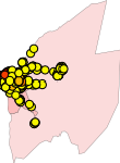
Corrientes - Precio de Suelo (2004)
Precio ofrecido del lote o terreno en pesos a trav...
Mostrando 10 de 358 mapas disponibles:
Corrientes - Superficie de Suelo Ofertada (2004)
Se componen con la superficie total ofrecida del l...
Corrientes - Superficie de Suelo Ofertada (2001)
Se componen con la superficie total ofrecida del l...
Índice maximo de magnitud de inundaciones 2000
Indica la magnitud máxima de daño que han alcanzad...
Corrientes - Precio de Suelo (2013)
Precio ofrecido del lote o terreno en pesos a trav...
Índice maximo de magnitud de inundaciones 1990
Indica la magnitud máxima de daño que han alcanzad...
Areas protegidas con manejo que permite el uso sustentable de recursos (UICN de categoria IV-VI)
Muestra el porcentaje de superficie protegida por ...
Corrientes - Precio de Suelo (2010)
Precio ofrecido del lote o terreno en pesos a trav...
Areas protegidas con manejo que permite la visita turistica-educativa (UICN de categoria II, III y V)
Muestra el porcentaje de superficie protegida por ...
Corrientes - Precio de Suelo (2007)
Precio ofrecido del lote o terreno en pesos a trav...
Corrientes - Precio de Suelo (2004)
Precio ofrecido del lote o terreno en pesos a trav...
Mostrando 10 de 358 mapas disponibles:
| Mapa | # Capas | Creado por | Fecha de creación | Fecha de modificación |
|---|---|---|---|---|
| Corrientes - Superficie de Suelo Ofertada (2004) | 2 | glosan | 28 Dic. 2015 15:11:53 | 15 Feb. 2016 16:04:41 |
| Corrientes - Superficie de Suelo Ofertada (2001) | 2 | glosan | 28 Dic. 2015 14:56:43 | 15 Feb. 2016 16:05:20 |
| Índice maximo de magnitud de inundaciones 2000 | 3 | mrapis | 28 Dic. 2015 14:49:50 | 13 Dic. 2020 21:31:49 |
| Corrientes - Precio de Suelo (2013) | 2 | glosan | 28 Dic. 2015 14:49:16 | 15 Feb. 2016 16:05:56 |
| Índice maximo de magnitud de inundaciones 1990 | 3 | mrapis | 28 Dic. 2015 14:47:38 | 3 Dic. 2020 02:08:51 |
| Areas protegidas con manejo que permite el uso sustentable de recursos (UICN de categoria IV-VI) | 3 | mrapis | 28 Dic. 2015 14:36:26 | 3 Dic. 2020 04:03:39 |
| Corrientes - Precio de Suelo (2010) | 2 | glosan | 28 Dic. 2015 14:34:53 | 15 Feb. 2016 16:08:56 |
| Areas protegidas con manejo que permite la visita turistica-educativa (UICN de categoria II, III y V) | 3 | mrapis | 28 Dic. 2015 14:34:34 | 2 Dic. 2020 22:23:21 |
| Corrientes - Precio de Suelo (2007) | 2 | glosan | 28 Dic. 2015 14:32:15 | 15 Feb. 2016 16:09:31 |
| Corrientes - Precio de Suelo (2004) | 2 | glosan | 28 Dic. 2015 14:16:22 | 15 Feb. 2016 16:10:15 |